Team Career Plan B · August 13, 2026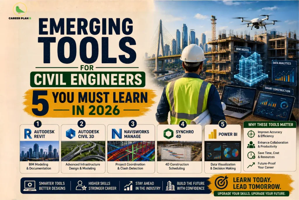
Introduction
If you are a civil engineer still relying solely on AutoCAD and MS Excel, here is an honest reality check: the industry has moved on. The construction and infrastructure sector is undergoing one of its biggest technological shifts in decades, and the emerging tools for civil engineers defining this shift are already becoming baseline expectations in job descriptions across India and globally.
From government-mandated BIM adoption in public infrastructure projects to AI-powered construction management platforms, technology is transforming civil engineering. It is no longer just an advantage. It has become a key career differentiator. Learning these tools early helps engineers get shortlisted faster. It also leads to higher salaries and more impactful project roles.
Despite this shift, many civil engineering students graduate without practical experience in these technologies. This blog explores the five most important emerging tools every civil engineer should learn in 2026. It explains what they are, where professionals use them, why they matter, and how you can start learning them today.
Why Civil Engineers Must Embrace New Technology
The global construction technology market is projected to reach $2.3 trillion by 2030. In India, programmes like PM Gati Shakti, the Smart Cities Mission, and the National Infrastructure Pipeline are not just pumping money into infrastructure; they are demanding smarter, faster, and more precise delivery of projects.
This shift is changing what employers expect from civil engineers at every level:
- BIM for civil engineers is now a requirement on most large-scale government and private infrastructure tenders
- GIS in civil engineering has become standard practice in urban planning, transportation, and disaster risk management
- AI and drone-based tools are cutting survey timelines from weeks to hours
- Companies consistently promote engineers with digital tool proficiency into project leadership roles.
The future of civil engineering belongs to professionals who combine traditional structural knowledge with modern digital skills. Here are the five tools to start with.
Tool 1: Building Information Modelling (BIM)
What It Is
BIM for civil engineers is a digital process that creates intelligent 3D models of infrastructure projects that carry not just geometry but also data about materials, costs, timelines, and maintenance requirements. It replaces siloed 2D drawings with a single, collaborative digital environment where architects, engineers, and contractors all work from the same model.
Key Software
- Autodesk Revit industry standard for BIM-based structural and architectural design
- Bentley OpenBuildings and OpenRoads widely used for transportation and infrastructure BIM
- Navisworks for clash detection and project coordination
Where It Is Used
Engineers now use BIM in large-scale buildings, metro rail projects, highways, bridges, and water infrastructure projects. The Central Public Works Department (CPWD) has issued official BIM guidelines mandating its use on government projects above a certain scale.
Why It Matters
BIM reduces design errors, improves coordination between disciplines, and significantly cuts rework costs on site. Employers increasingly prefer engineers with BIM proficiency for senior project roles.
Tool 2 GIS (Geographic Information Systems)
What It Is
GIS in civil engineering is a spatial analysis technology that maps, analyses, and visualises geographic and infrastructure data. It allows engineers to overlay multiple data layers terrain, soil type, flood zones, utilities, and population density to make informed infrastructure planning decisions.
Key Software
- ArcGIS (Esri), the industry-leading GIS platform used by government agencies and large consultancies
- QGIS a powerful, free, and open-source alternative ideal for students and early professionals
Where It Is Used
GIS is essential for transportation planning, urban development, pipeline routing, disaster risk assessment, and watershed management. It is a core tool for digital tools for infrastructure planning at both central and state government levels.
Official Resources
- Survey of India the national mapping agency providing official geospatial data
- National Remote Sensing Centre (NRSC), ISRO, for satellite imagery and geospatial data relevant to infrastructure planning
Tool 3 Drone Technology and UAV Surveying
What It Is
Unmanned Aerial Vehicles (UAVs), commonly known as drones, are transforming land surveying for large-scale civil engineering projects. They capture high-resolution aerial images and LiDAR data. Engineers then process this data to create accurate topographic maps, 3D terrain models, and volumetric calculations.
Key Software
- DJI Terra for drone flight planning and data processing
- Pix4D widely used for photogrammetry and mapping
- Agisoft Metashape professional-grade 3D model generation from drone imagery
Where It Is Used
Engineers now use smart construction tools such as drones on highway projects, dam inspections, flood mapping, mining surveys, and large-scale urban developments. These tools reduce survey timelines from weeks to hours. They also improve accuracy, especially in challenging terrain.
Official Regulation
Drone operations in India are regulated by the Directorate General of Civil Aviation (DGCA). Civil engineers operating drones professionally must comply with India’s Drone Rules 2021. Drone certifications are also available through the Digital Sky Platform.
Tool 4 Finite Element Analysis (FEA) Software
What It Is
Finite element analysis is a computational method that simulates how structures respond to loads, stress, vibration, heat, and other physical forces. It allows engineers to test structural behaviour digitally before construction begins, identifying weaknesses that manual calculations may miss.
Key Software
- STAAD Pro, the most widely used structural analysis software in India for buildings, bridges, and industrial structures
- ANSYS used for advanced simulation, including dynamic and thermal analysis
- SAP2000 preferred for bridge and seismic analysis
Where It Is Used
FEA software is essential for civil engineering software workflows in the design of bridges, high-rise buildings, industrial structures, offshore platforms, and earthquake-resistant infrastructure. It is a core skill for structural engineers across both government and private sectors.
How FEA Differs From Traditional Structural Design
Traditional structural design relies on simplified manual calculations based on standard code assumptions. FEA models the actual behaviour of complex structures under real-world conditions accounting for non-linear material behaviour, dynamic loads, and irregular geometries that manual methods cannot accurately capture.
Tool 5 AI-Powered Design and Project Management Tools
What It Is
Artificial intelligence is entering civil engineering technology in two powerful ways: generative design tools that optimise structural and spatial layouts automatically and project management platforms that use AI to predict delays, flag risks, and optimise resource allocation in real time.
Key Software
- Autodesk Construction Cloud AI-integrated platform for construction project management, document control, and quality tracking
- Procore widely used construction management software with AI-driven reporting
- Alice Technologies AI-powered construction scheduling that models thousands of project scenarios to find the most efficient build sequence
Where It Is Used
Large EPC contractors, infrastructure consultancies, and government project management units increasingly use these tools. They rely on them to plan, manage, and deliver complex multi-crore infrastructure projects.
How AI Is Reshaping Civil Engineering Technology
AI tools are not replacing civil engineers; they are eliminating the most time-consuming and error-prone parts of the job. Engineers who know how to use these platforms can manage larger, more complex projects with greater precision and far less manual overhead.
Have Any Doubts?
How to Learn These Tools: Official and Free Resources
You do not need expensive courses to get started. Here are credible, accessible learning resources:
- NPTEL free online courses on GIS, BIM, and structural analysis from IIT faculty
- Autodesk Education Community free student licences for Revit, AutoCAD, and Navisworks
- QGIS Official Documentation and Tutorials: free GIS learning
- DGCA Digital Sky Platform drone certification pathway
- MeitY Skilling Initiatives: government-backed digital skill programmes
- National Skill Development Corporation (NSDC) skilling programmes for technical professionals
How Career Plan B Helps
Knowing which tools exist is one thing; knowing which ones to prioritise for your specific career direction is another. Career Plan B helps civil engineers and students make that distinction clearly. Their PsycheIntel career assessment tests identify your strengths and the career paths most aligned with your aptitude, helping you decide whether to focus on BIM, GIS, structural software, or project management tools. Their Career Roadmapping service then builds a step-by-step upskilling plan tailored to your goals, whether you are targeting government infrastructure roles, private sector EPC firms, or international opportunities. For those considering postgraduate specialisation to deepen their civil engineering technology expertise, Career Plan B’s Admission and Academic Profile Guidance ensures you apply to the right programmes with a compelling profile.
For Latest Information
Frequently Asked Questions (FAQs)
- Which software is most important for civil engineers in 2025?
BIM software like Autodesk Revit and structural analysis tools like STAAD Pro are currently the most in-demand across job postings. GIS proficiency is increasingly expected for roles in urban planning and infrastructure consultancy. Ideally, develop competency in at least two of the five tools covered in this blog.
- Is BIM mandatory for civil engineering projects in India?
BIM adoption is being progressively mandated for government infrastructure projects in India. The CPWD has issued BIM guidelines for public sector projects, and several state governments are following suit. For large-scale private sector projects, BIM is already a standard requirement..
- Can I learn GIS and BIM for free?
Yes. NPTEL offers free GIS and BIM courses taught by IIT faculty. Autodesk provides free student licences for Revit and other BIM tools. QGIS is entirely free and open source.
- How do these tools improve job prospects for civil engineers?
Employers across government, consultancy, and EPC sectors increasingly filter candidates based on digital tool proficiency. Engineers with BIM, GIS, or FEA skills consistently receive more interview calls, higher starting salaries, and faster career progression into senior project roles compared to peers without these skills.
Conclusion
The gap between civil engineers who rely only on traditional methods and those who master emerging tools for civil engineers is growing every year. Technologies such as BIM, GIS, drone surveying, finite element analysis (FEA) software, and AI-powered project management tools are becoming industry standards. They are no longer advanced specialisations. Instead, they form the foundation of modern civil engineering practice.
The good news is that most of these tools are accessible, learnable, and supported by free official resources. The only thing standing between you and a future-ready skill set is a clear plan and the decision to start.
If you want a personalised roadmap for which tools to learn and how to position yourself for the roles you want, visit Career Plan B to speak with a career counsellor and get started.
Infrastructure is getting smarter and so should the engineers who build it.